Continuing my solo adventures around Edinburgh. This time, I decided to head on a day trip to the nearby Berwick-upon-Tweed in England, the first stop of the train from Edinburgh to London. The views from the train ride were magnificent, so I wanted to spend more time in this beautiful town.
Disclosure: Please note that this post contains affiliate links. This means that if you click on a link marked with [AD] and proceed to make a purchase, I may earn a small commission at no extra cost to you.
Berwick-upon-Tweed is located close to the border of England and Scotland on the English side in the county of Northumberland. However, if you read the history of the place, you will see that Berwick-upon-Tweed changed hands multiple times in the past before settling in the English side. For this reason, the town is full of fortifications.
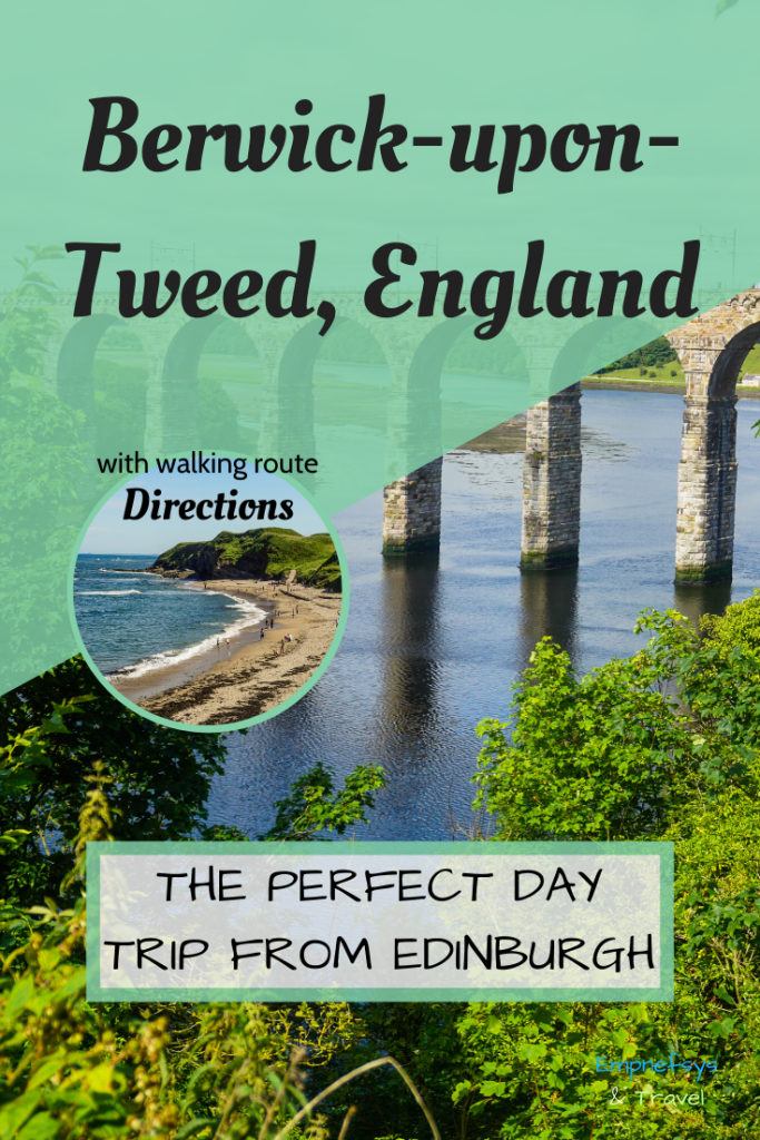
As the name suggests, Berwick-upon-Tweed lies on the shore of the River Tweed up to the point it meets the North Sea. The two sides of the river are connected by the Royal Border Bridge, a photogenic attraction of the town. Other highlights of the town are the ruins of the Berwick Castle, the Berwick town walls, the Lighthouse and the Berwick-upon-Tweed Barracks and Main Guard.
Read below, to find a walking itinerary that covers all these places along with directions on how to reach the town. It is the perfect route for a day trip to Berwick-upon-Tweed that covers all the must-see sights.

Getting to Berwick-upon-Tweed
It is very easy to reach Berwick-upon-Tweed by train, as it lies on the east coast route that connects London and Edinburgh. Berwick-upon-Tweed is about 3h30mins from London by LNER trains. From Edinburgh and Newcastle-upon-Tyne, you can reach Berwick-upon-Tweed in about 45 minutes by LNER or CrossCountry trains. From any other place in the UK, you should first head to one of these three cities and then take a train to Berwick-upon-Tweed.
Buy your train tickets easily and quickly using Trainline. [AD]
A walking route for a day trip to Berwick-upon-Tweed
The walking route for this day trip to Berwick-upon-Tweed covers the most important places of interest of the town. It begins by following part of the Castle Parks Trail (click here for the official map brochure) and then follows the medieval fortifications around the town with a short detour at the Berwick Lighthouse and the museums. A short stop at the town centre for lunch is also included.
Note: It was not possible to create a Google Map with directions to all the stops of the route, because some of the paths I took are not registered on Google Maps. Instead, I drew an outline of the walk on the image below. To get the Google Maps equivalent, click on the image.
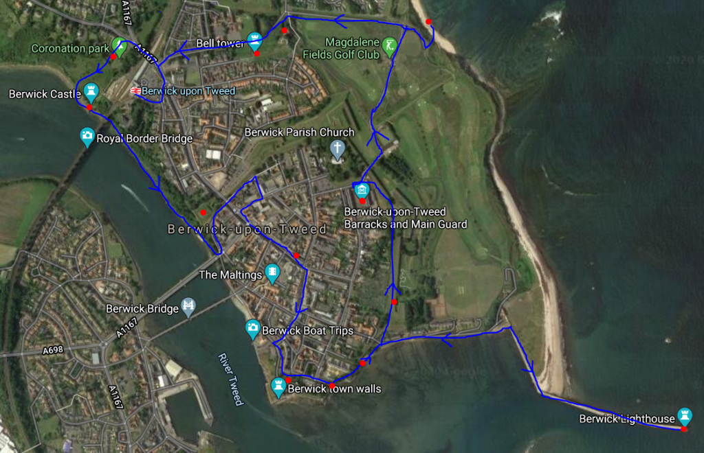
Tip: Start the walk on a summer day at around 10 am to have time to visit the museums before closing time. To follow it in the winter, you may want to start your walk a bit earlier to have time to see everything during daylight. Bear in mind that the museums included may be closed.
Stops: Coronation Park, Royal Boarder Bridge, Castle Vale Park, Meg’s Mount, Town Hall, Quay Wall, Main Guard House, Coxon’s Tower, Plommer’s Tower/Fisher’s Fort, Berwick Lighthouse, King’s Mount, Berwick-upon-Tweed Barracks and Main Guard, Beach, Lord’s Mount, Bell Tower
Section 1: Castle Parks Trail
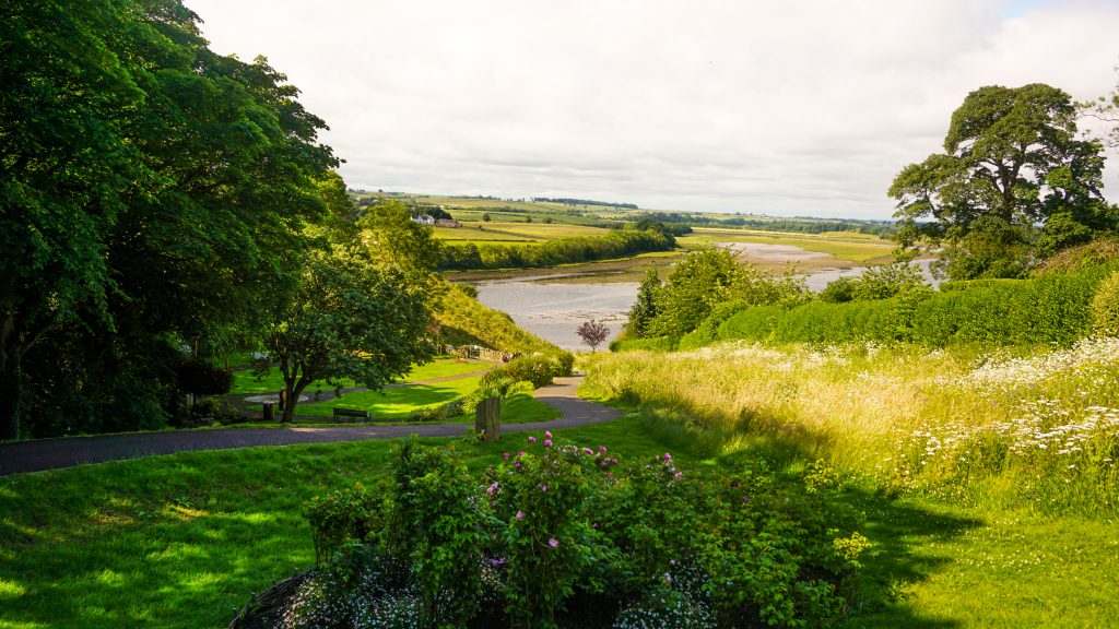
The walk starts at the Coronation Park and continues onto Castle Vale Park via Tommy the Miller’s Field. Both parks were created in the 1930s and have a similar design. Upon entering the Coronation Park from the side of the train station, you then follow the walking path until it meets the River Tweed. Turn left to face the Royal Border Bridge and continue until you reach the remains of the Berwick Castle. Spend some time at the castle to read the signs and learn more about its history.
The Royal Border Bridge is frequently used by trains. As I passed from this bridge a few times now, I can tell you that the views are magnificent. If you are coming to Berwick-upon-Tweed from the south of the UK and sitting on the right-hand side (left-hand side for leaving the town), you will be able to enjoy these views too!
Continue your walk into the Castle Vale Park and walk along the river facing the other two bridges. If you want to get some panoramic views of the Royal Border Bridge, enter the Castle Vale Park and follow the stairs to the street. Once you have your photos, come back to continue the trail.
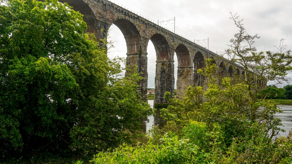
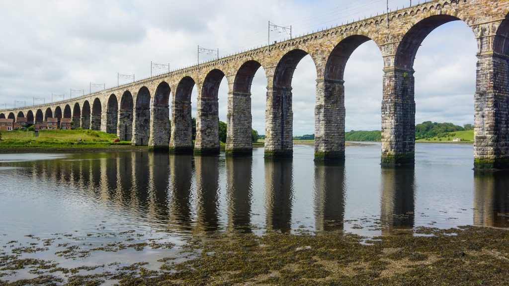
Shortly after passing a small hut, walk underneath the bridge and climb up to the main street. To get a panoramic view of the Royal Border Bridge, walk up to the midpoint of the bridge and then return. Turn left before getting into the main road towards Meg’s Mount. Meg’s Mount is another stop of the historic route around Berwick-upon-Tweed which also offers great views of the Royal Border Bridge.
Find out more about Beriwck-upon-Tweed Castle and Ramparts here.
Section 2: Town Centre
The next part of the route takes you into the town centre. There you can have a quick lunch break or grabbing something to eat at another point of the walk. An important building that doesn’t go unnoticeable is the Town Hall at the other end of the street.
Section 3: Medieval Fortifications Part I
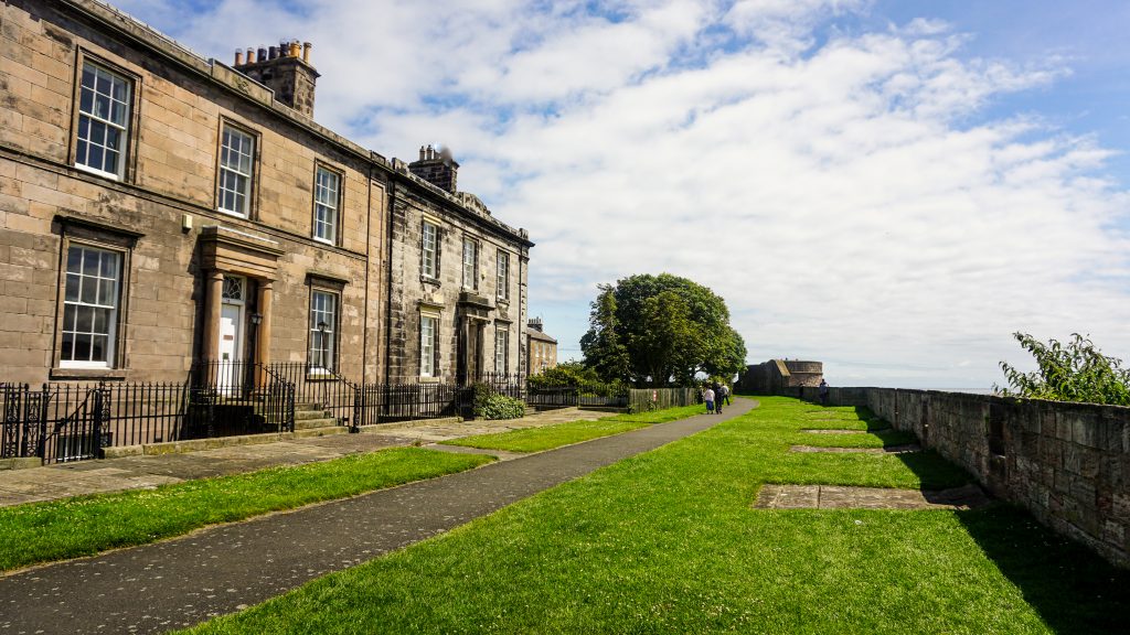
After passing the town hall, turn right into Hide Hill road and continue straight until you arrive at the Quay Walls. Turn left and follow the route until the point the walkway forks. Keep on the right-hand side and continue walking along the medieval walls until the Main Guard House. Coxon’s Tower should be the next point of interest with views (if you are tall enough) of the North Sea. After that, the Plommer’s Tower/Fisher’s Fort section follows. Can you spot the Lighthouse from there?
Section 4: The Lighthouse
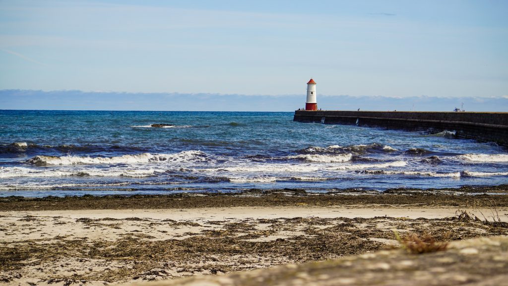
Once you reach another part of the path that forks, keep left (on the side of the road) and then turn right to pass underneath the bridge. Follow the Pier road until it ends and then turn right and follow the path to the Lighthouse. It may seem like a long way there, but it was my favourite part of the route with amazing views!
Section 5: Medieval Fortifications Part II


To get back to the original path, get back the same way, pass again under the bridge, return to the section that the road forks and follow the other path that takes you to the King’s Mount. Note that there is a short-cut along the Pier Road which takes you by the tennis club, through the playground area to the King’s Mount. This is the route I took, but I find it very difficult to retrace it on Google Maps, so follow it on your own risk.
Section 6: Museums and Galleries
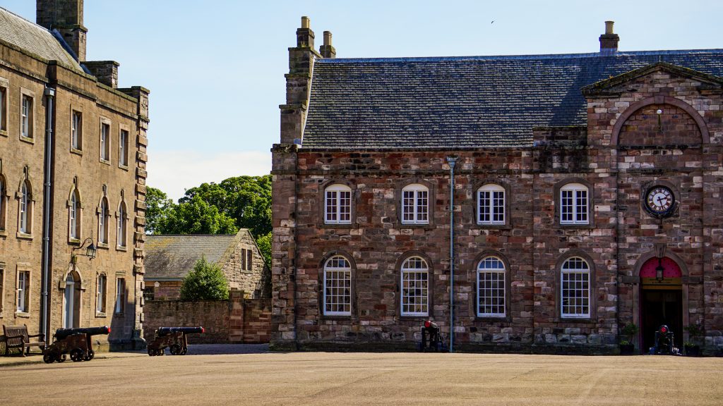
After reaching King’s Mount, continue on this quiet path overlooking the North Sea. At some point, you will reach the Gymnasium Gallery. It houses temporary exhibitions that may worth checking out. (On the Quay Walls you can also find the Granary Gallery.) Next to the gallery, you can find the Berwick-upon-Tweed Barracks and Main Guard.
The Berwick-upon-Tweed Barracks and Main Guard is the place to go to learn more about the history of the area. It is managed by the English Heritage and it houses the ‘By Beat of Drum’ exhibition, the King’s Own Scottish Borderers Museum and the Berwick Museum and Art Gallery. In the summer, the place closes daily at 6 pm, so by the time you reach this part of the route, there should be enough time to see the exhibitions. There is an entrance fee.
Find out more about the Berwick-upon-Tweed-Barracks and Main Guard here.
Section 7: Beach break
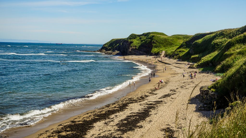
Once you are done with the museums, exit the complex and turn right. Follow the road and pass by a narrow bridge to find yourself below the path you were walking before. Keep following the road until you reach the beach. En route, you will pass Magdalene Fields Golf Club. At the car park of the beach, follow the small path to get to the sea level. Have a short break by the sea before returning to the car park.
Section 8: Medieval Fortifications Part III
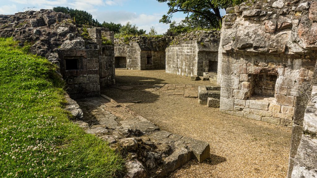
From the car park, head west and right before the end of the road turn left. At some point, on your right hand side should be a small opening which allows you to get into the park were the Lord’s Mount is. Walk around the ruins and see the nearby Bell Tower. This is the last stop of the walk. Once you are ready to leave, head to the main road (Northumberland Avenue) and turn left. Continue straight until you reach the train station.
Photo Gallery
Click on a photo to enlarge.


All photos were taken using the camera Sony ILCE-5100 [AD] and the 16-50mm [AD] or 55-210mm [AD] lense unless otherwise specified.
P.S. This is a walking route, I created on the spot. I hardly prepared for this day trip to Berwick-upon-Tweed. Instead, I was following all the places of interest I found on Google Maps.
Did you like this post? Save it for later!
