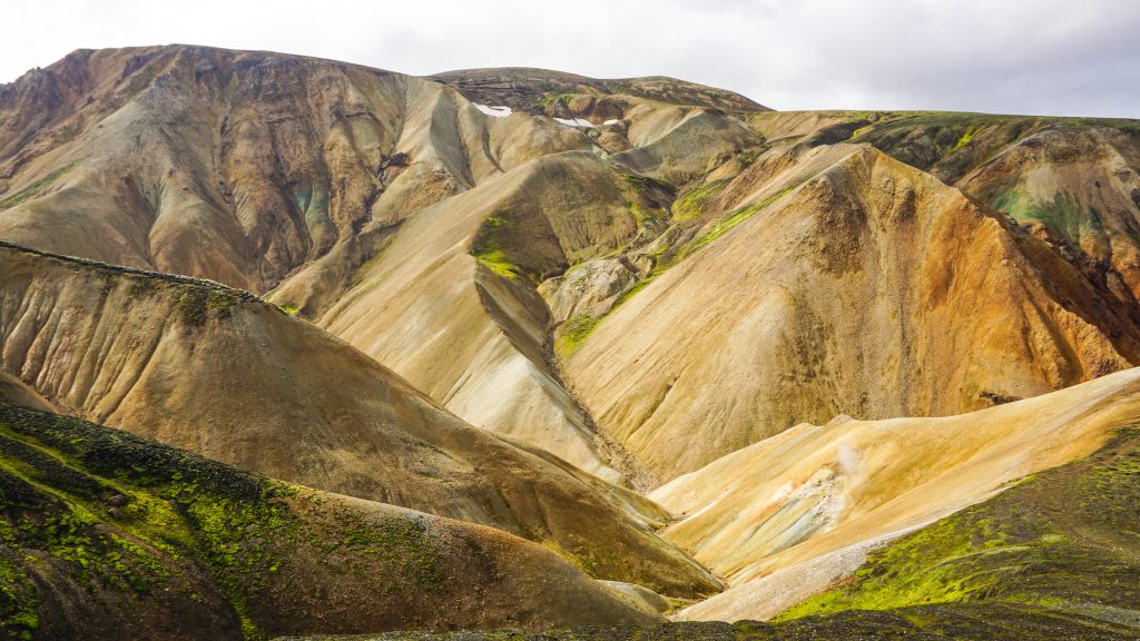
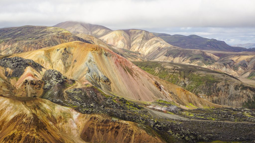
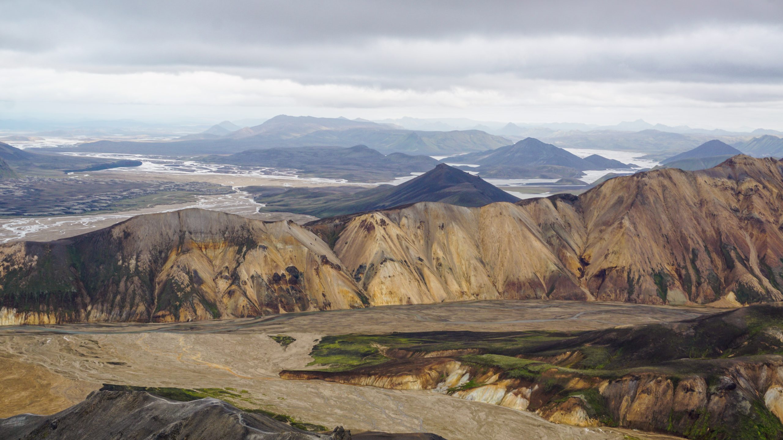
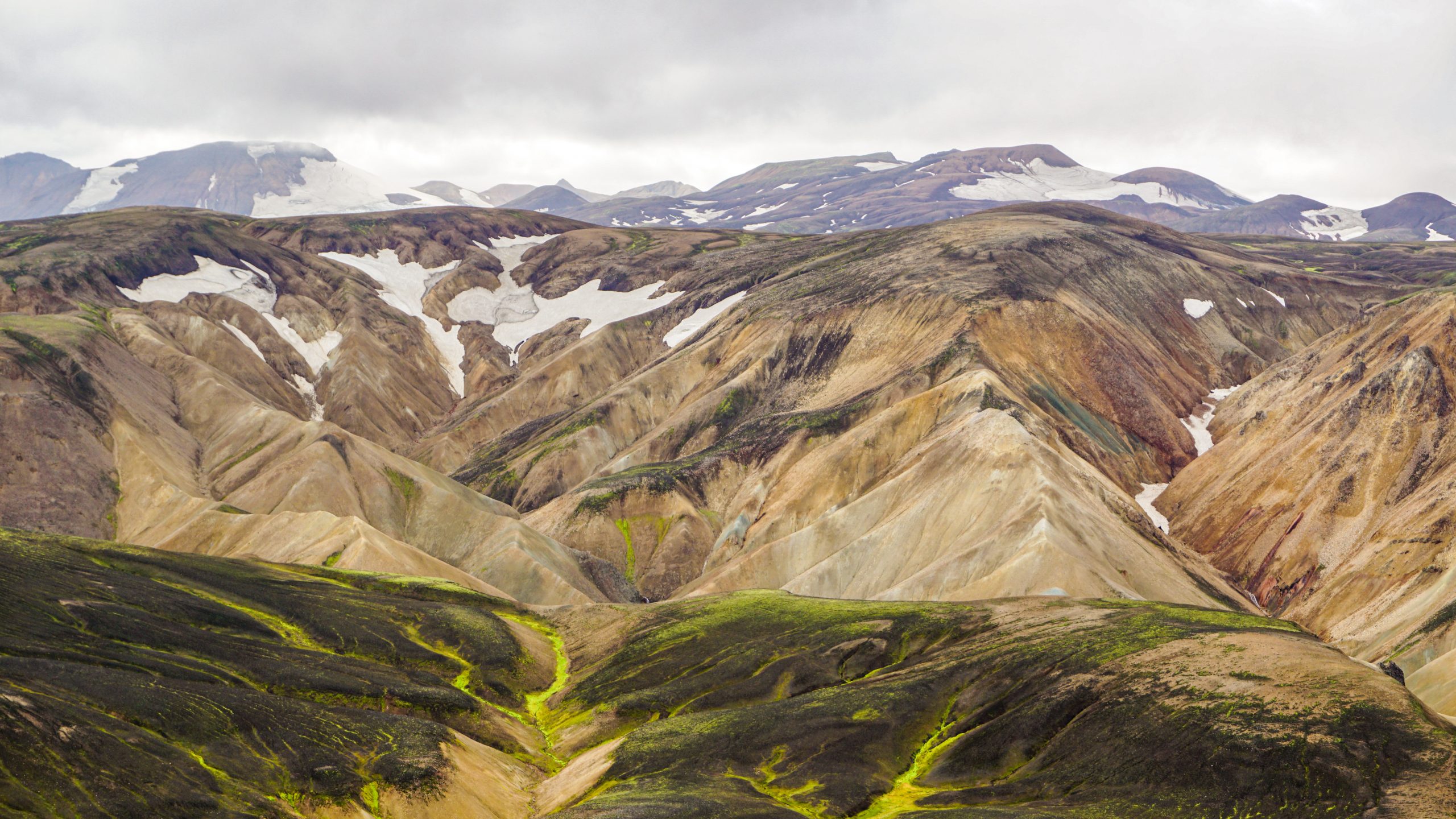
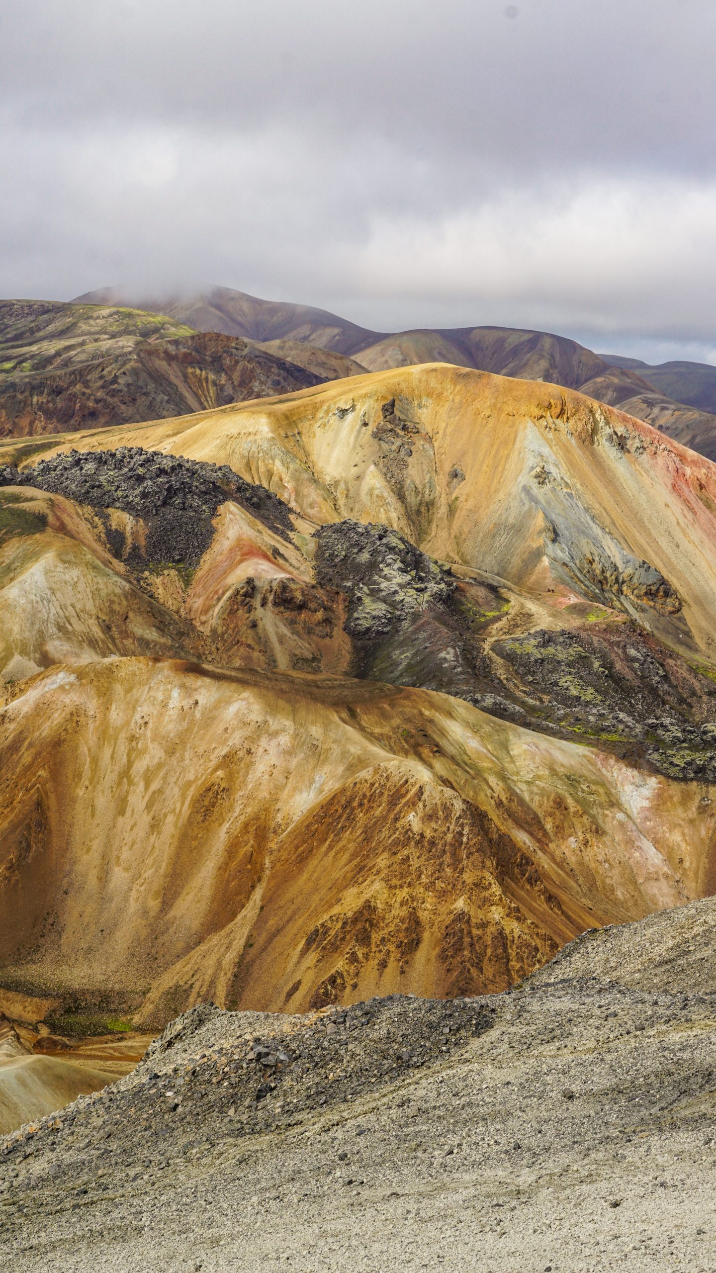
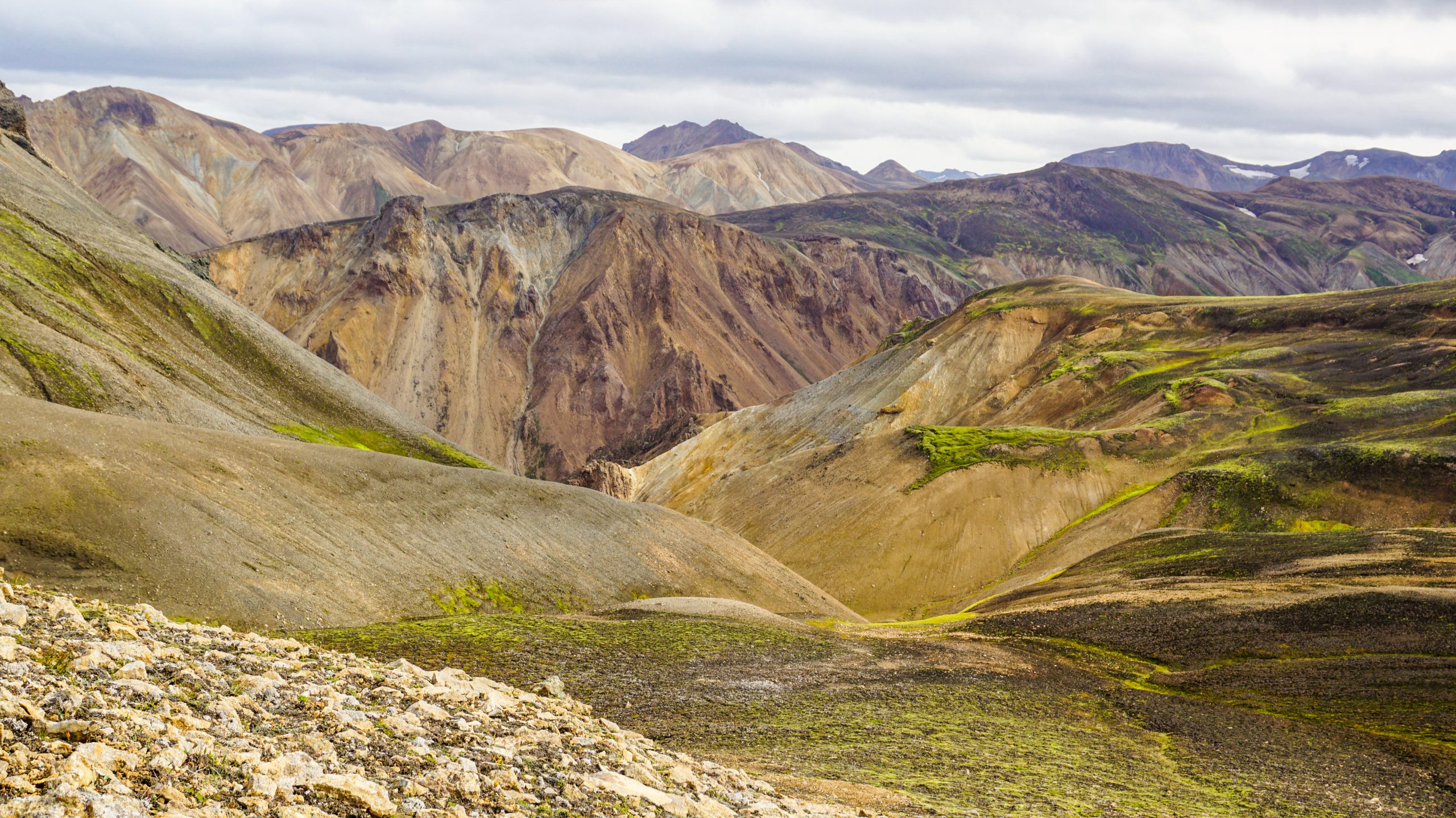
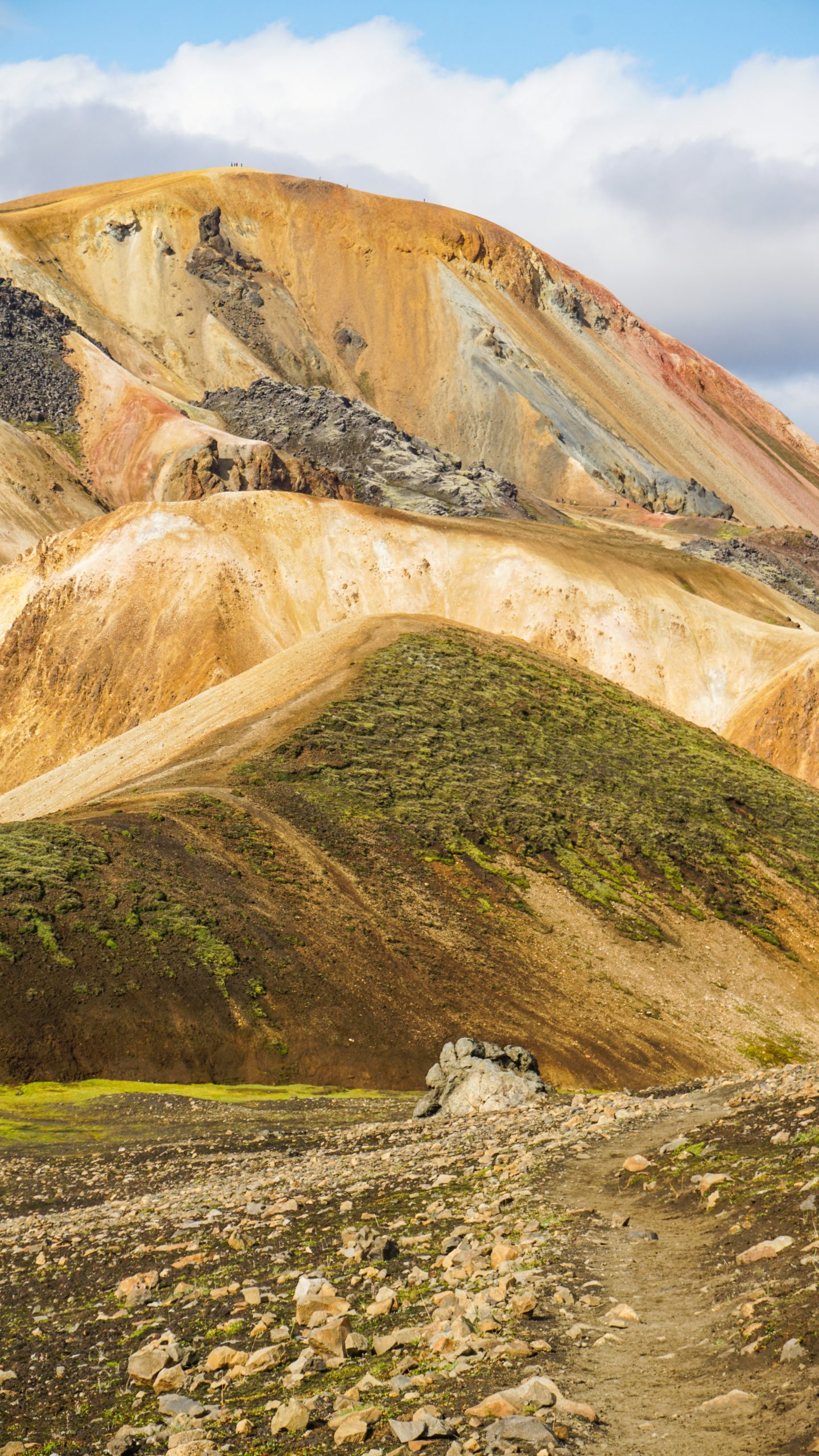
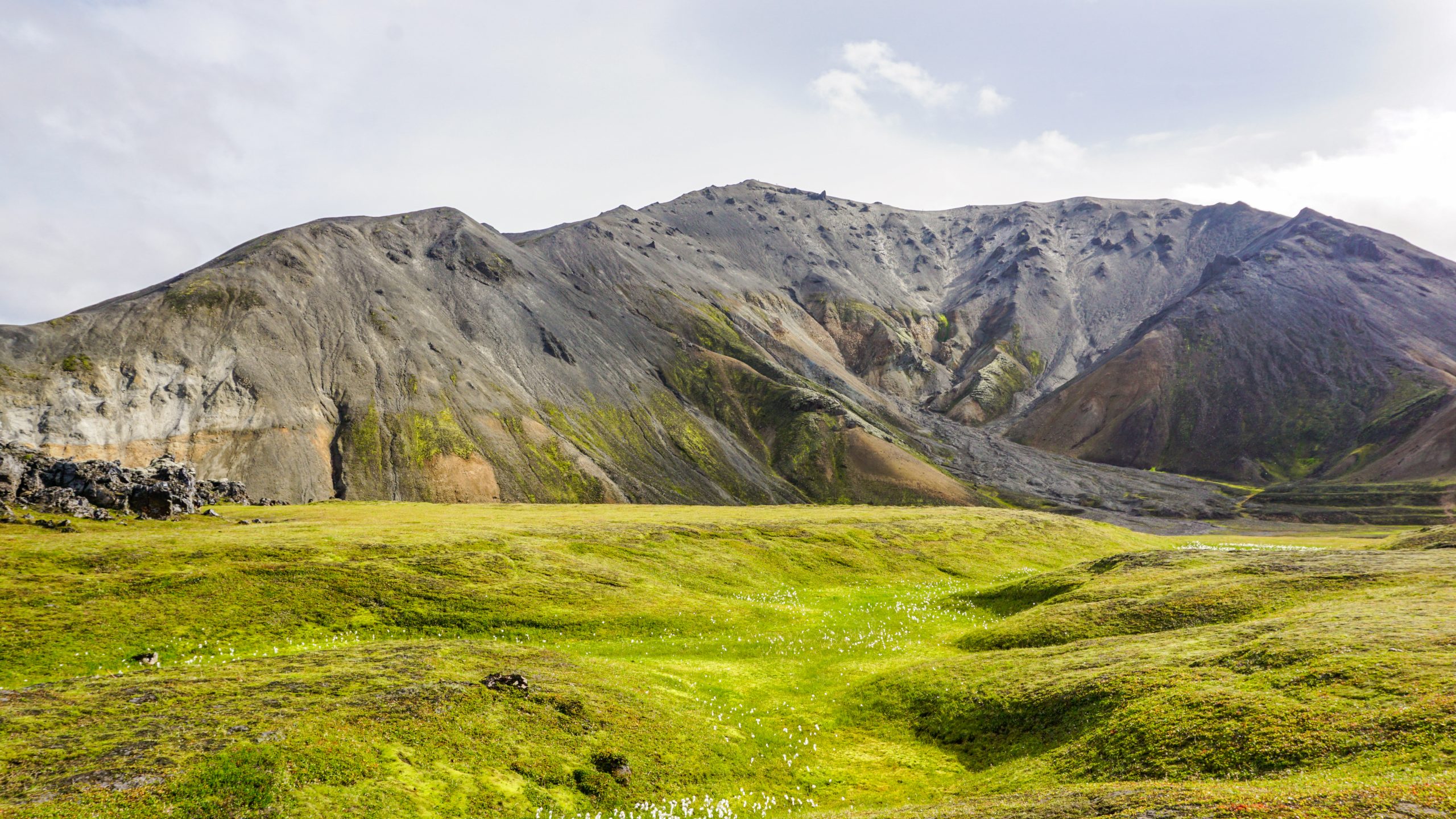
Landmannalaugar is an impressive location in the Icelandic Highlands. Look at any photo of Landmannalaugar online and you will immediately be amazed by the beauty of the landscape. You may even wonder if such a place really exists and if the photos are not just a smart manipulation of colours in some photo editing software. Well, I can reassure you that Landmannalaugar is real and it is indeed that colourful!
Disclosure: Please note that this post contains affiliate links. This means that if you click on a link marked with [AD] and proceed to make a purchase, I may earn a small commission at no extra cost to you.
Read on to learn more about Landmannalaugar, how to visit, and what you can do there. And if you are still indecisive about whether you should visit Landmannalaugar on your next trip to Iceland, the photo gallery at the end of this post will definitely help to make up your mind.
Get to known Landmannalaugar
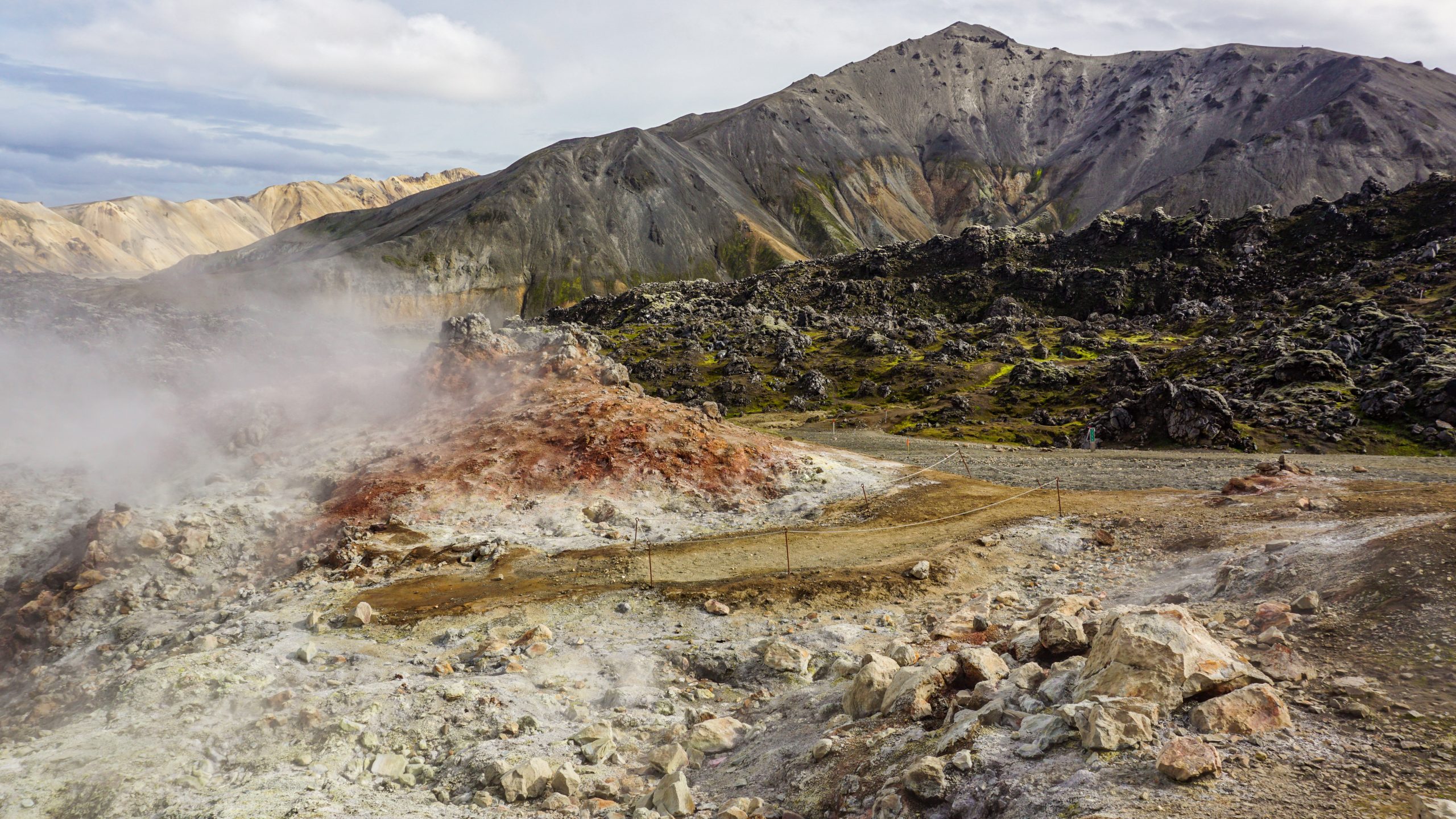
Landmannalaugar is part of the Fjallabak Nature Reserve in the southern Icelandic Highlands. A volcanic eruption in the 15th century created this unique terrain and the geothermal pools of the area. The solidified magma of the eruption and the rhyolite rock of the mountains are the reasons the area is so colourful.
Landmannalaugar is also known as the “People’s Pool” due to the many natural hot pools you can find there. In the past, travellers visited the valley to use these hot pools to restore and freshen up after their long hikes in the highlands. This continues until today, with many people seeking to use the hot springs to relax after a long day.
How to get to Landmannalaugar
As Landmannalaugar is located in the highlands it is not as straightforward to get there as other places in Iceland. It is about 3.5 hours from Reykjavík and it involves passing through some tough roads. It is possible to drive there but only if you have a 4×4 vehicle.
Alternatively, you can get there using the highland bus or by joining an organised tour. There are transfer-only tours as well as guided ones that follow specific hiking trails, like this one [AD]. Most tours and transfers depart from Reykjavík, but there are a few you can join from locations closer to Landmannalaugar.
Note that access to Landmannalaugar is only during the summer months (usually from mid-June to early September). For the rest of the year, the conditions can be rough and the roads can be completely covered with snow.
Driving to Landmannalaugar
If you choose to drive to Landmannalaugar you will need to have a 4×4 car (or campervan). The reason is that to get there you will need to use the F-roads which are only accessible to 4×4 vehicles. F-roads are not for everyone though. They are characterised by rough terrain and even some river crossings. Ideally, you would need some experience driving on this type of road.
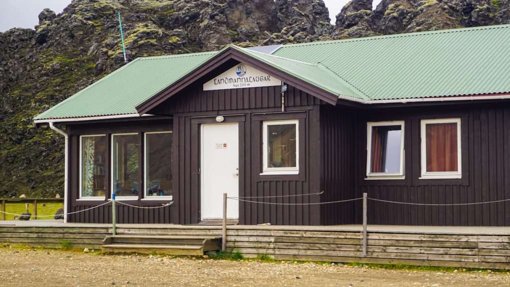
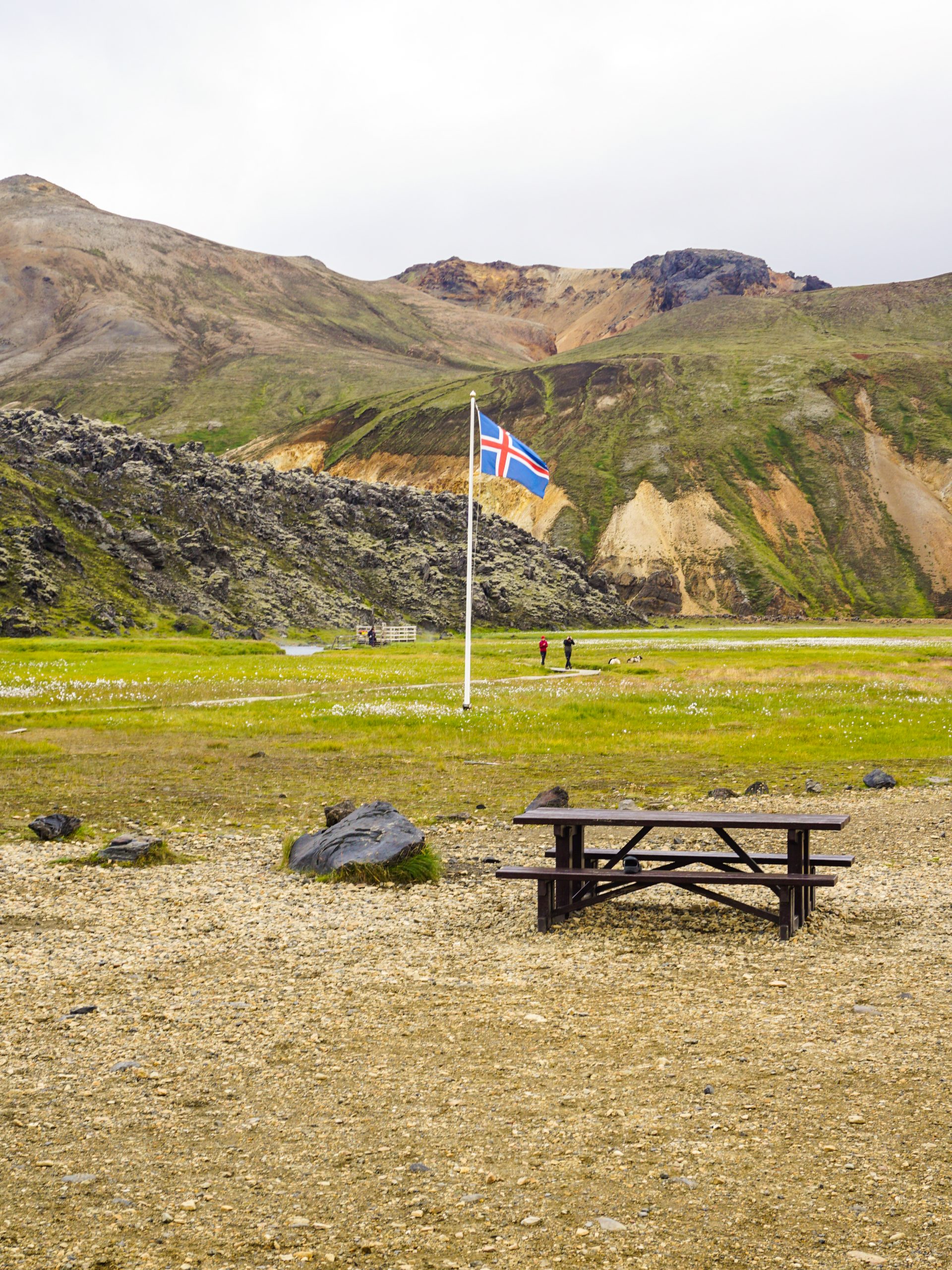
There are a few parking lots around Landmannalaugar with the main one being at the camping area. This is where you will also find some amenities (toilets, showers and a small kiosk) as well as an information desk. The GPS coordinates of the campsite are 63.9909357, -19.0605729.
Remember to follow the driving etiquette while using the F-roads (and all roads in Iceland) by staying within the marked path and not driving off-road. The force of driving on unmarked roads can damage the fragile nature of Iceland. (The same is true when following a marked hiking trail).
If you need to rent a car to get there, check out Rentalcars.com [AD] to find the ideal car for your needs.
Taking a transfer or a tour
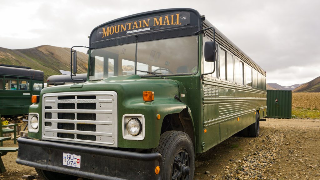
The easiest way to get to Landmannalaugar if you don’t have a 4×4 car or you aren’t comfortable driving there is to take the highland bus. A highland bus is a modified bus that is able to handle the F-roads in Iceland. It will mostly be a bumpy ride but at least the driver will be familiar with the terrain.
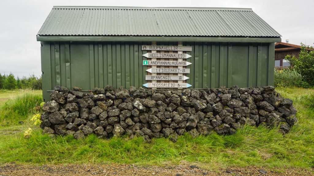
There are a few companies offering bus services to Landmannalaugar during the summer season, with usually one service per day. The most popular are Reykjavik Exursions and Trex. Their buses depart from Reykjavík and stop at Hella and Rjúpnavellir along the way.
If you are already road-tripping around Iceland, then I suggest you get on the bus from Rjúpnavellir which is very close to the furthest point you can drive with a standard car before entering the highlands. In this way, you will spend the least time on the bus and save some money on the fare.
Highland bus timetables and fares
You can find out the latest timetables of fares of the buses from their official websites (Reykavik Excursions and Trex). There is usually a bus departing from Reykjavík between 6:30 am and 7:30 am which arrives at Landmannalaugar campsite at around 11:30 am. The buses start departing from Landmannalaugar at around 3:30 pm and arrive in Reykjavík 4 hours later.
It is recommended to book in advance to ensure you get a seat on the bus but it is still possible to get a ticket from the driver. Return fares cost from 10 500 to 17 500 ISK depending on the pickup/drop-off point and company. This translates to around £60 – £105, €75 – €125 and $85 – $140. Yeap, a bit expensive for a bus ticket! 😉
In addition, there are highland bus routes to other locations in the southern highlands connecting popular multiday hiking routes with Reykjavík. If you plan to follow one of those trails (see below for more details), then it’s better to get a hiking pass that allows you to return from a different location than the one you took the bus to.
Where to stay in Landmannalaugar
Landmannalaugar is great for a day trip, but if you want to follow more hikes or do one of the multi-day trails starting from there, then you need to consider accommodation. The most popular option is to bring a 4×4 campervan which will also double as your bed for the night. Alternatively, you can camp there using a tent and a sleeping bag. The nightly fee per person is 2 500 ISK.
If you want more protection against the elements, there are some huts with beds and kitchens you can stay in. The huts can accommodate up to 78 people and need advance booking. Each bed there costs 10 200 ISK.
Landmannalaugar Campsite Amenities
The campsite is very organised with plenty of facilities. There are toilets and showers, a common area with benches, drinking water, rubbish collection points and even a small kiosk selling snacks and drinks.
Day visitors who want to use the toilets or the benches need to pay a facility fee of 500 ISK. The price drops to 400 ISK if you buy the pass online. To use the showers there is an additional cost of 500 ISK.
As Landmannalaugar is a popular place for visitors there are rangers around the campsite. They can help you navigate your way in the area and provide directions for the various hikes. The hiking routes are marked with different colours. You can find which colours correspond to each route by purchasing a paper map (300 ISK) from the information desk.
You can find out more information about the campsite and pay the facility fee from the Iceland Touring Association, Ferðafélag Íslands (FÍ).
Things to do in Landmannalaugar
The main thing to do in Landmannalaugar is to follow one of the hiking trails that depart from the base camp. Which trail(s) you can follow depends on how much time you will have there.
If you take the bus to Landmannalaugar you will have about 4 hours to spend. This is enough time to follow one or two of the smaller hikes or enjoy a dip in the hot springs.
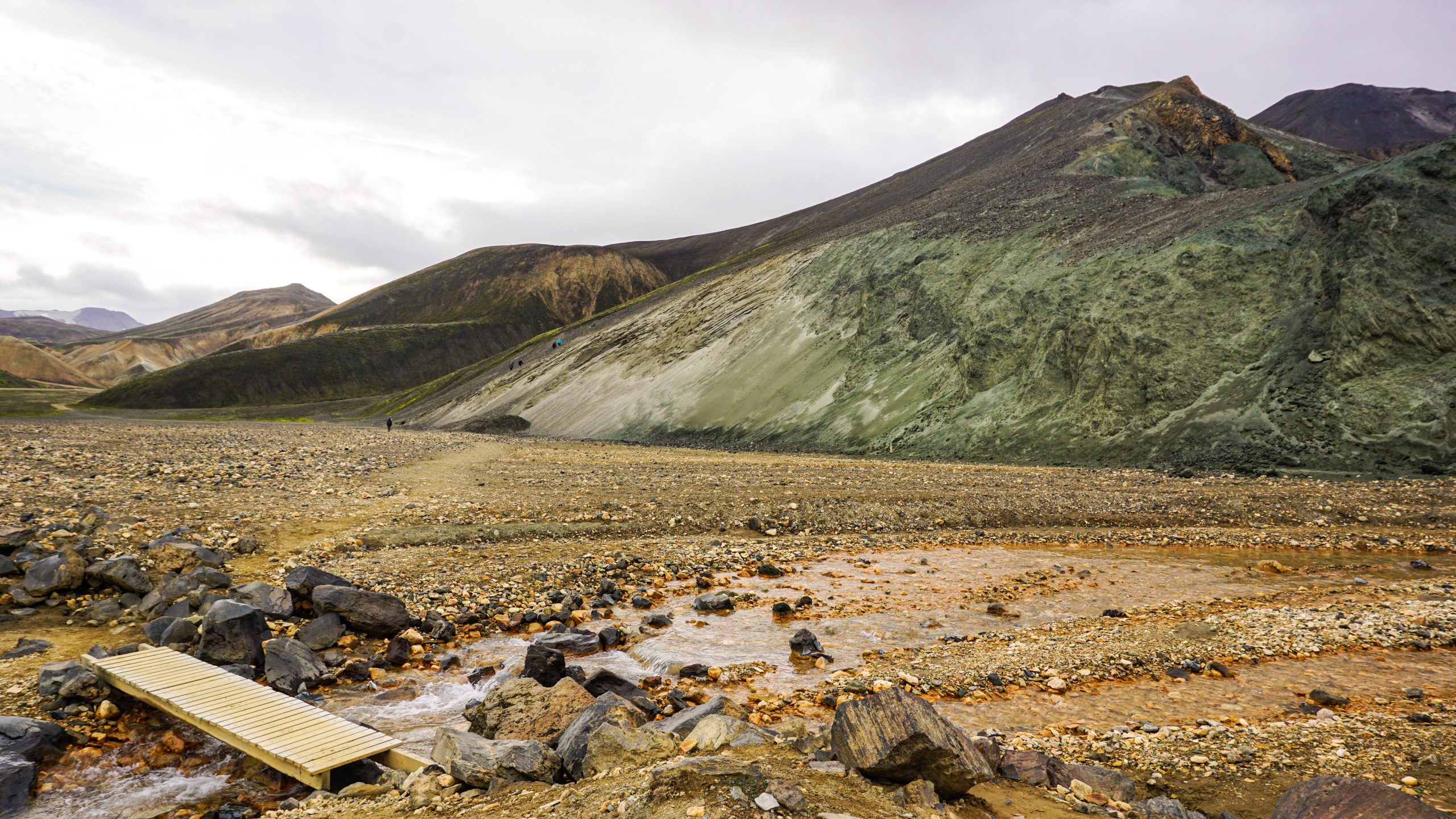
Conveniently enough, the hot springs are located very close to the campsite so you don’t have to walk a long way to reach them. If you want to find them on Google Maps the site is labelled as “Landmannalaugar Bathing Place”.
In terms of hiking trails, there many options to choose from. Below I will put some trails you can follow sorted based on duration. I include the type, difficulty, duration and distance of the hike along with a few words about why you should follow that route.
Activities for day visitors
There are many trails that are doable in a day. Although if you will depend on the bus, then you will need to be a bit more careful with the timings. You don’t want to be in the middle of nowhere when the last bus of the day departs from the campsite.
Some of the most popular day-hikes are:
Laugahraun
Type: Circular
Difficulty: Easy
Duration: 1.5 – 2 hours
Distance: 4.3 km
Highlights: The path goes through some solidified lava fields. An easy hike to get a glimpse of the uniqueness of the area.
Brennisteinsalda
Type: Circular
Difficulty: Moderate
Duration: 3 hours
Distance: 6.6 km
Highlights: Brennisteinsalda is a volcano mountain 855 m in height. It is also known as the “Sulphur Wave” and the hike there is an extension of the Laugahraun trail. It ascends and descends about 300 m and has great views from the top.
Blahnúkúr
Type: Circular
Difficulty: Moderate to Difficult
Distance: 3 – 3.5 hours
Duration: 6.1 km
Highlights: Blahnúkúr is the hike to the “Blue Peak” at 945 m. It features some challenging ascends and descends but with amazing views from the top.
Sudurnámur
Type: Linear (normally circular)
Difficulty: Moderate to Difficult
Duration: 6 hours (normally 4 – 4.5 hours)
Distance: 11.4 km (normally 8.5 km)
Highlights: This trail ascends Sudurnámur peak at 882m. The trail used to be a circular trail but recently parts had to be closed off due to erosion so the 8.5 km loop can’t be fully completed without turning back before reaching the main peak.
Ljótipollur
Type: Circular
Difficulty: Easy to Moderate
Duration: 5 – 6 hours
Distance: 13.3 km
Highlights: Ljótipollur means “Ugly Pond” but it’s anything but an ugly volcano crater lake. The trail takes you a bit further from the main campsite to an area known for being covered in green moss before reaching the crater. In addition, you can also expand the route to include the Stútur crater. If you have a car you can drive to a car park closer to the starting point of the hike and save yourselves a 5 km return walk.
Multiday hiking route
Landmallanaguar is the starting (or ending) point of a long hiking trail to (or from) Þórsmörk, another popular area in the Icelandic highlands. The trail is called Laugavegur and it is 54 km long. It takes around 4 days to complete and it has been rated as one of the most beautiful hikes in the country.
The route passes through many different types of terrain and landscapes including but not limited to lava fields, black sand deserts and forested areas. You will also need to cross a few rivers on foot. Overall, it can be a demanding hike with unpredictable weather conditions and even limited visibility at points. You need to be well prepared to follow this hike and have some experience with hiking long distances.
I will not get into further details as I haven’t done this hike, but there are plenty of resources online that can help you prepare. The FÍ website has more information about it, including details about huts and directions.
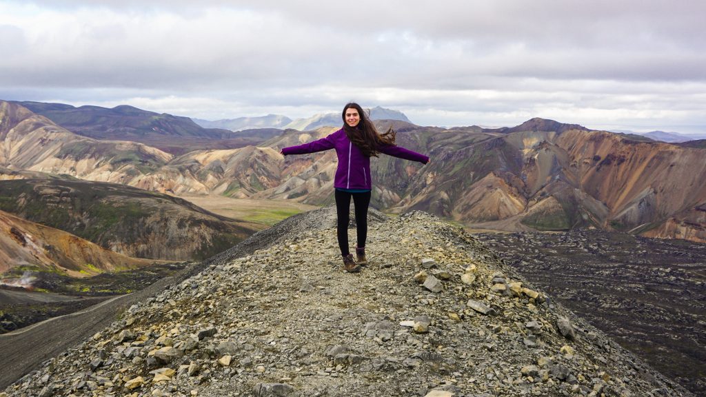
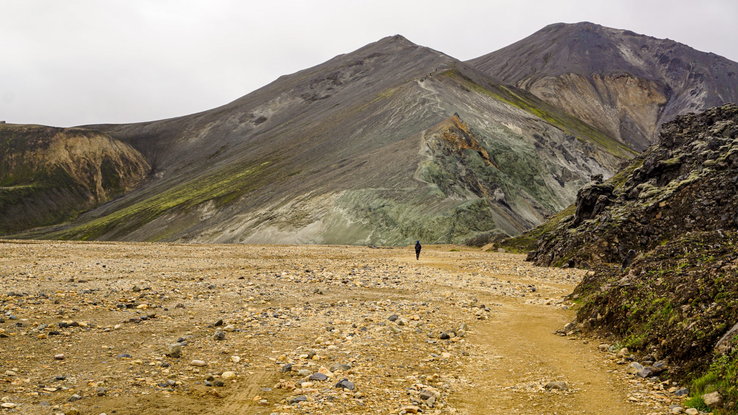
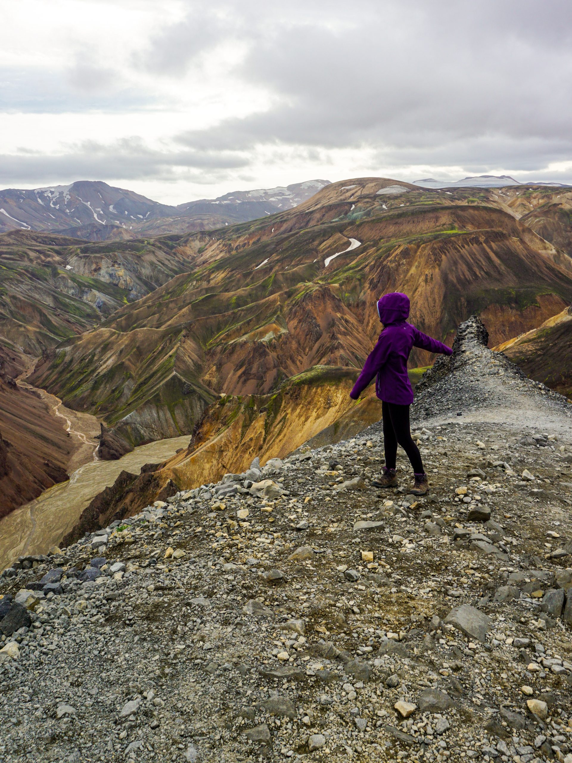
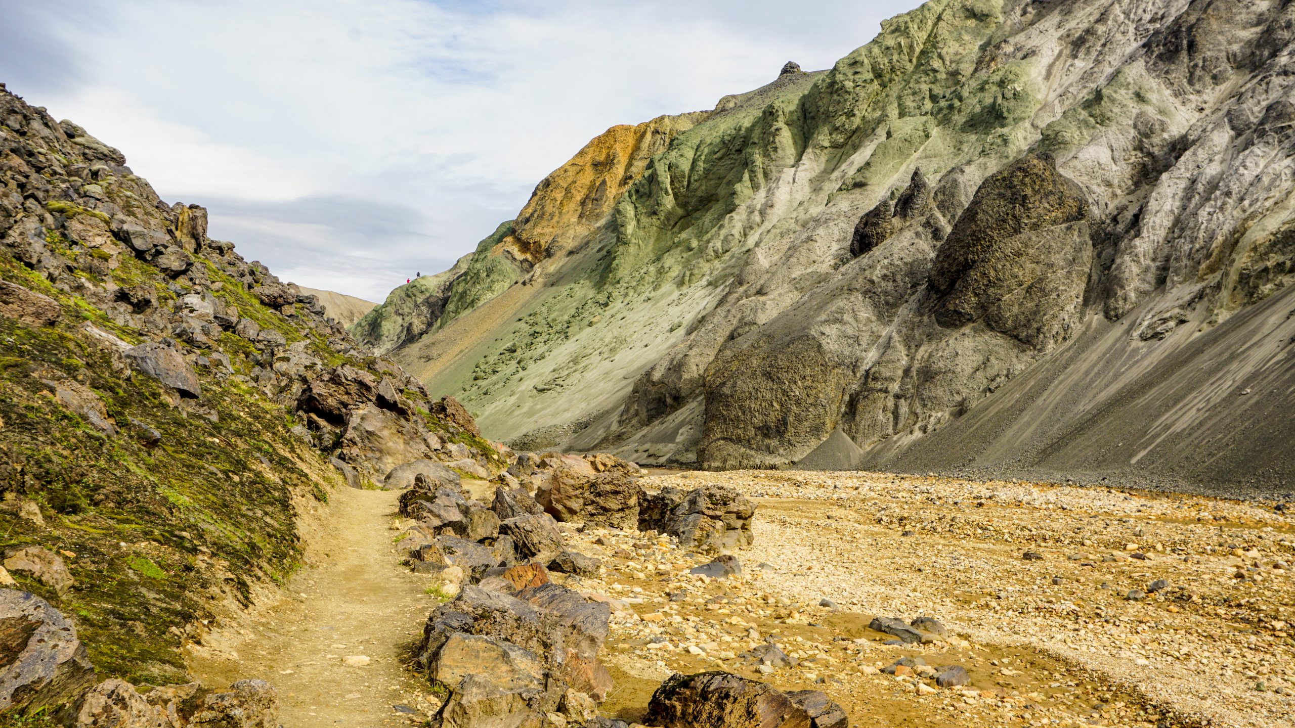
Hike to Blahnúkúr
When Christos and I visited Landmannalaugar, we went there using the highland bus so we only had time for one activity. We chose to follow the hike to Blahnjúkur because of the beautiful views we would encounter along the way. It is fair to say that it was the most difficult hike we had done up to that point. Not for being too long (we have walked for longer amounts of time), but for being very steep at large parts of the route.
Here, you will find a quick overview of the hike we followed and some tips for when you will be on the road.
The basics
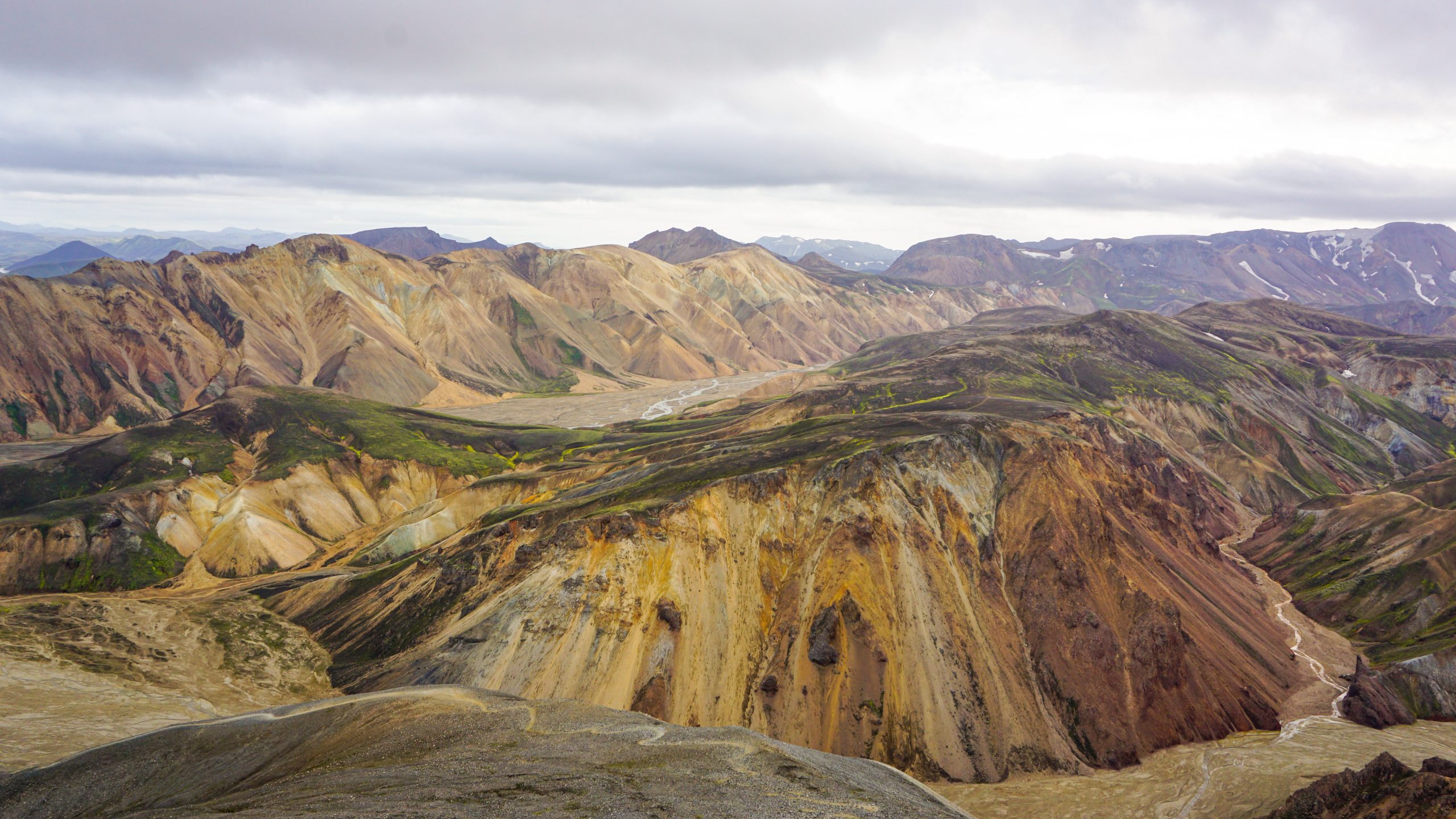
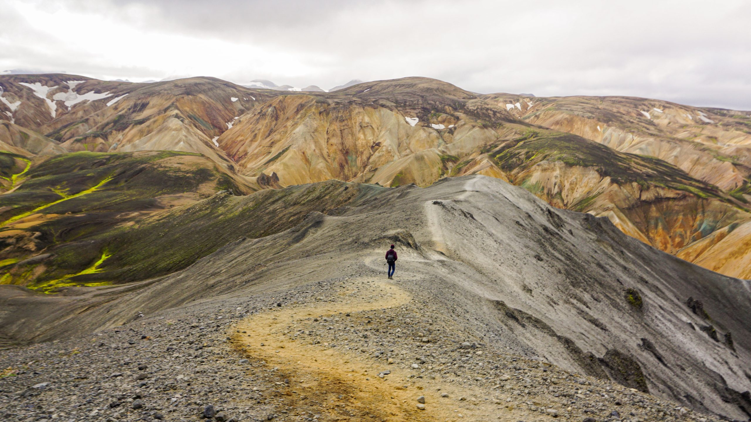
The Blahnúkúr hike follows a circular route to the top of Blahnúkúr volcano. The name Blahnúkúr means Blue Peak and it comes from the dark blue colour of the mountain. It has an elevation of 945 m and the total height you have to ascend from the campsite is around 380m.
The complete loop is around 6.1 km long and takes 3-3.5 hours to complete depending on your fitness level, with people completing it even in 2.5 hours. In our case, it took us about 4 hours. Luckily, we didn’t have any issues with the bus leaving before us as we arrived a few minutes earlier than planned and had a total of 4.5 hours there.
Route Overview
When we visited the trail was marked with yellow signs, but double-check that with a ranger or a map before starting the route.
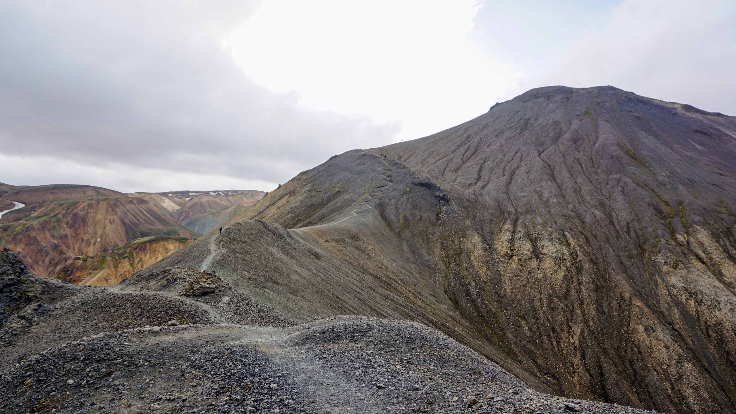
As the trail is circular, you can follow the route in either direction. Keep in mind that the peak is not at the mid-point of the hike. Based on the direction you will choose you will either start with a steep ascend directly to the peak, followed by a steep descent to the other side of the mountain and then a long hike around the mountain leading back to the campsite or the other way around. The hike back to the campsite is very long (much longer than you would expect) and it includes areas where you need to pass through some sharp rocks.
The map below suggests starting with the long hike and then climbing the mountain. This is the opposite of what we did and I think it really helped our morale the fact that we were able to see the peak and have an idea of where we were heading to. Leaving the big ascend for the end, might mean that you will be more tired once you reach the peak.
Nevertheless, whichever way you choose to follow, the views from the top of Blahnúkúr will definitely reward you, especially on a nice day with good visibility! The colours of the mountains around you will be insane and you may be able to spot some glaciers in the distance.
Tips for visiting Landmannalaugar for a day
Here are some tips to have in mind when visiting Landmannalaugar for a day:
- Bring plenty of snacks and water with you; buying items from the mountain hut can be expensive.
- Have a first aid kit with you; it’s very easy to cut yourself while following the rocky terrain of the Blahnúkúr trail.
- Wear plenty of warm layers; the temperature can vary depending on where you are on the trail.
- Have a bathing suit and a towel with you if you want to swim in the hot springs.
- Bring some hiking poles with you; they can be useful if the trail you will follow has steep and narrow parts.
- Wear sturdy shoes, ideally not your usual trainers but some type of hiking shoes.
- Have some kind of offline map with you; the paper map available at the information desk does not show the routes in detail and you don’t want to depend on the weak phone signal along the trail.
- If you will be taking a bus to get there:
- Ensure that you return to the campsite well before the departure time of the last bus of the day, unless of course, you are prepared to camp! So keep, an eye on the time while on the trail.
- If you are taking the bus to a place other than Reykjavík, double-check with the driver if you are boarding the correct bus. Don’t just assume it will be the same as the bus that brought you there, for us it wasn’t.
Photo Highlights from Landmannalaugar
There is no better way to finish this post than with some photos from our day in Landmannalaugar and our hike to Mt. Blahnúkúr. Enjoy the colourful scenery! You can click on the photos to enlarge them.
All photos were taken using the camera Sony ILCE-5100 [AD] and the 16-50mm [AD] or 55-210mm [AD] lense unless otherwise specified.
P.S. I really enjoyed the landscape at Landmannalaugar but to be fair we did visit on a nice day. Yes, it was cloudy at parts and a bit windy at the peak but overall we could enjoy some stunning views. I don’t know if I would have enjoyed it as much (or any at all) if it was a completely foggy and rainy day.
Did you like this post? Save it for later!
Pingback: How to Visit Iceland Without a Car - Empnefsys & Travel
Love your tips! A first aide kit is a great idea!
Thank you! I’m glad that you found this useful!
Looks incredible, lovely tips!
Thank you!
What a beautiful place to visit! Only got to visit Reykjavik in Iceland so I’m excited to get back there and explore more!
I hope you manage to get there soon!
I loved my day trip to Landmannlaugar. Your article brings back me nice memories of this trip. Thanks for sharing!
Happy to hear that!
I wasn’t familiar with Landmannalaugar before this, thanks so much for sharing. The views are absolutely breathtaking, I would love to hike this!
I’m glad that you found this useful!
Wow, thanks for putting Landmannalaugar on my radar. I’d love to hike here — it’s simply breathtaking!
Yeah, it was truly amazing! I hope you make it there some day!
Thank you for sharing such helpful tips. Loved the pictures.
Thank you! I’m glad that you found this useful!
I will be saving this for later! Great recommendations for day hikes in the area
Great to hear that!
Pingback: 3, 5 & 7-Day Iceland Itineraries for First Time Visitors - Empnefsys & Travel